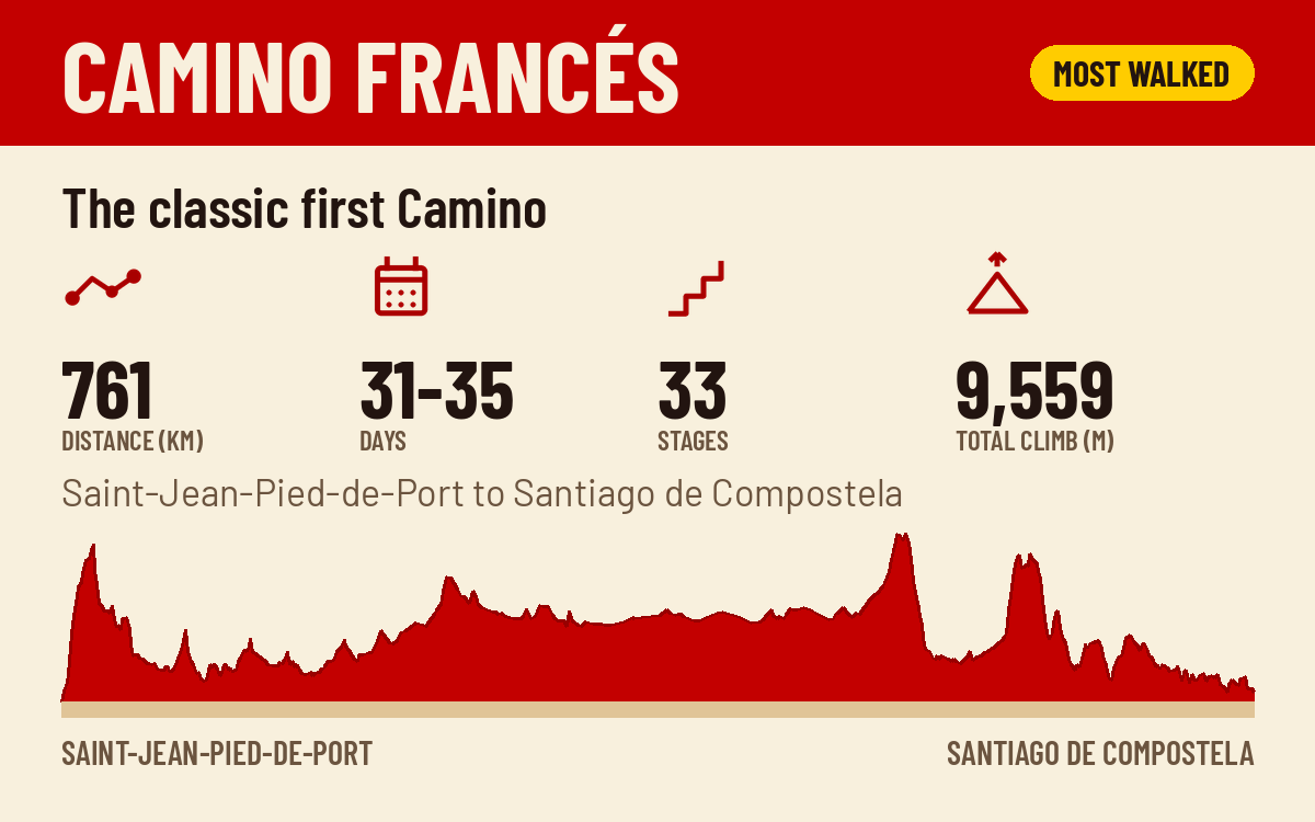
The classic first Camino
Camino Francés
The classic route. Over the Pyrenees, through Pamplona and the meseta, and down into Galicia.
761 km · 31 to 35 days · Saint-Jean-Pied-de-Port to Santiago de Compostela
 Camino View
Ten routes, one finish line. Every guide has the same bones: quick facts, a full stage table with distances, the sections at a glance, when to walk, and practical notes from the road. Start with the Francés if it is your first Camino. Pick a quieter route if it is not.
The classic first Camino
The classic route. Over the Pyrenees, through Pamplona and the meseta, and down into Galicia.
761 km · 31 to 35 days · Saint-Jean-Pied-de-Port to Santiago de Compostela
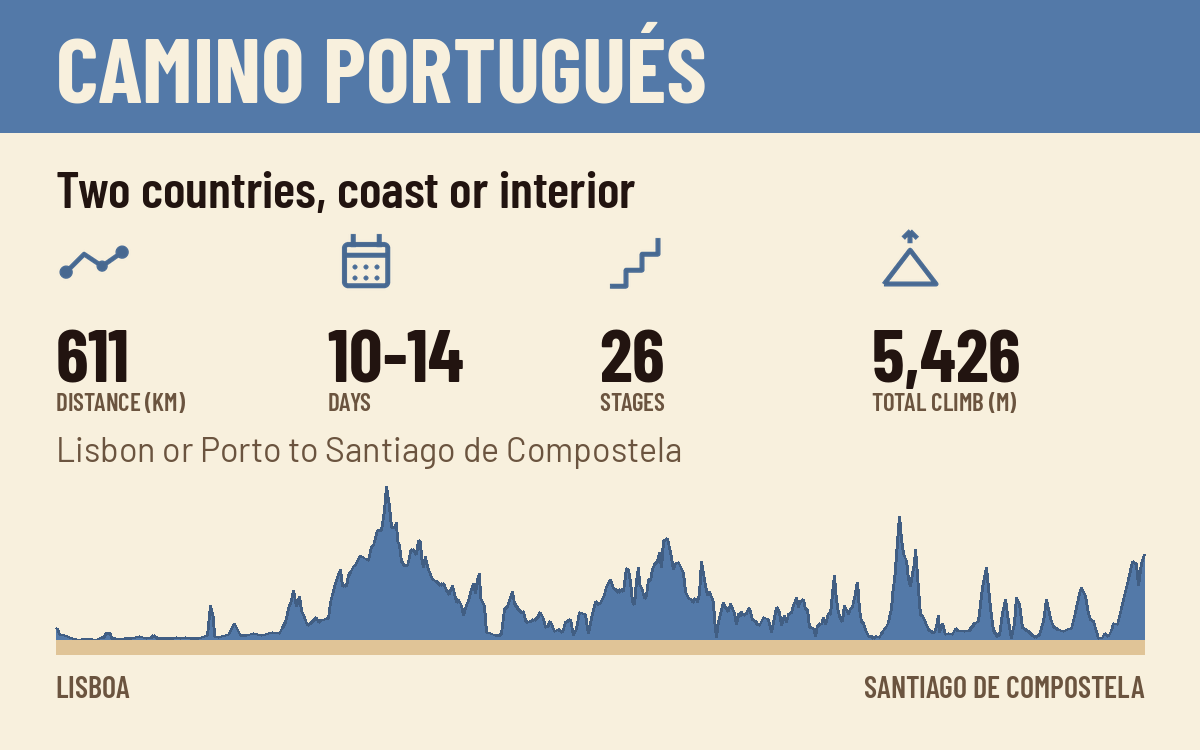
Two countries, coast or interior
The second most walked Camino. The Central and Coastal routes from Porto, plus the Spiritual Variant.
611 km from Lisbon, 267 km from Porto · 10 to 14 days from Porto · Lisbon or Porto to Santiago de Compostela
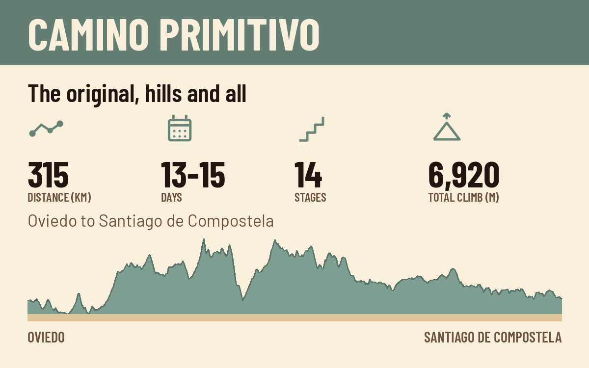
The original, hills and all
The original Camino and the hardest of the popular routes. Mountains, mud, and very few crowds.
315 km · 13 to 15 days · Oviedo to Santiago de Compostela
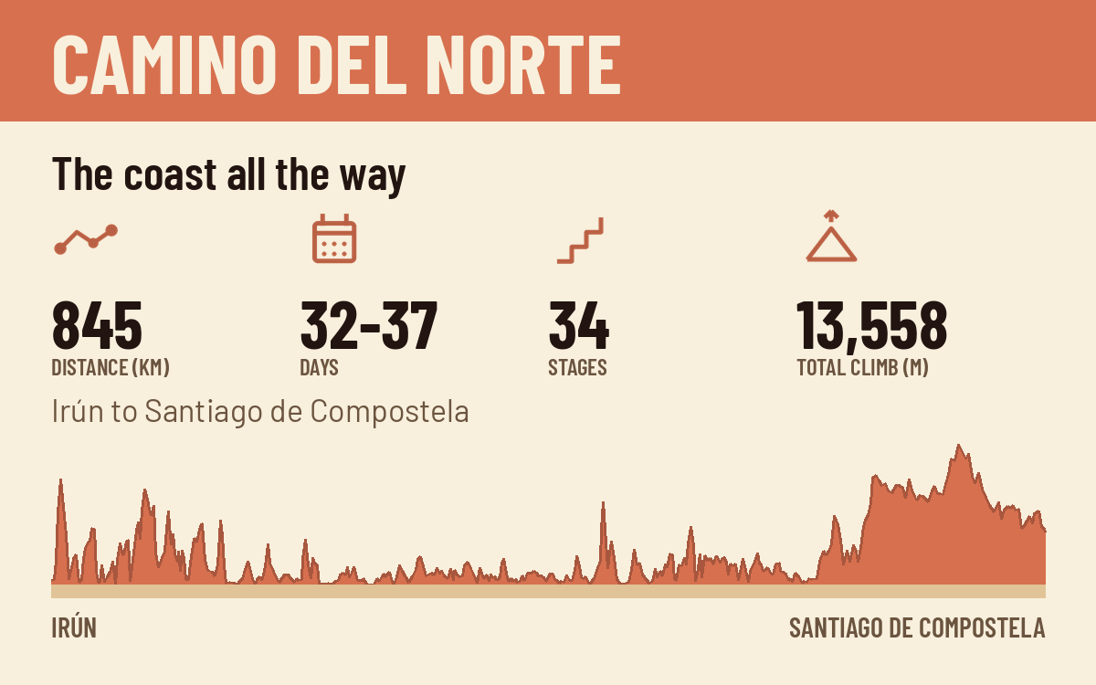
The coast all the way
The coastal route along Spain's northern shore. Cliffs, surf towns, and long green stages.
845 km · 32 to 37 days · Irún to Santiago de Compostela
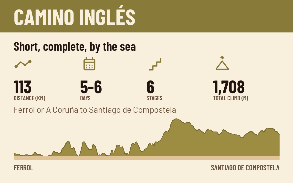
Short, complete, by the sea
The short one. A complete Camino in under a week, and long enough to earn the Compostela from Ferrol.
113 km from Ferrol · 5 to 6 days · Ferrol or A Coruña to Santiago de Compostela
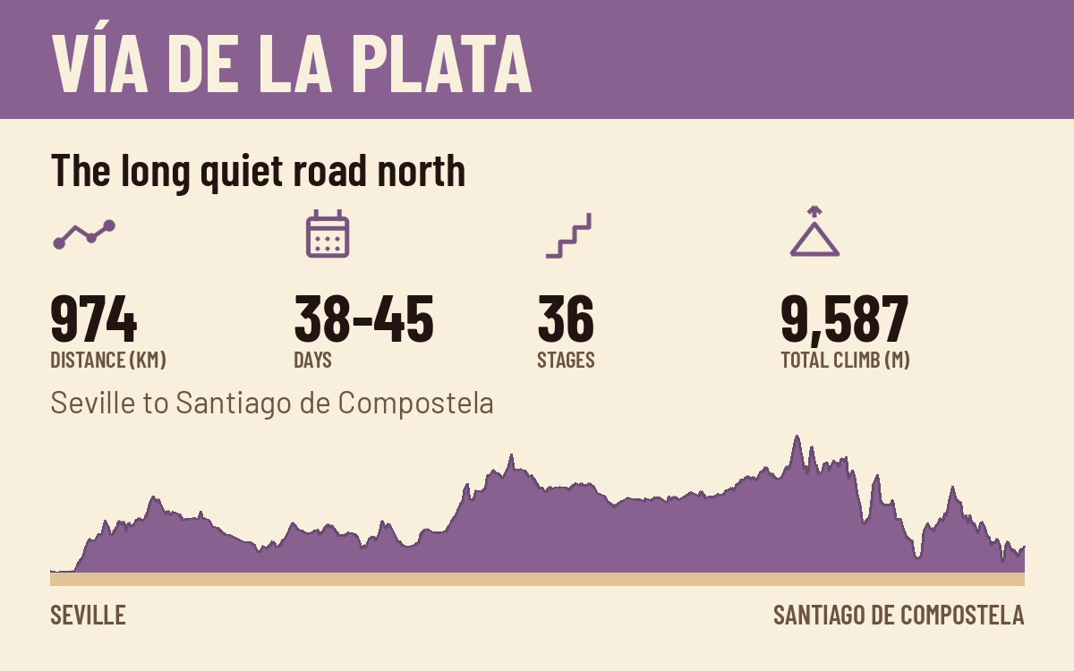
The long quiet road north
The long southern road. Roman roads, empty horizons, and serious heat if you time it wrong.
974 km · 38 to 45 days · Seville to Santiago de Compostela
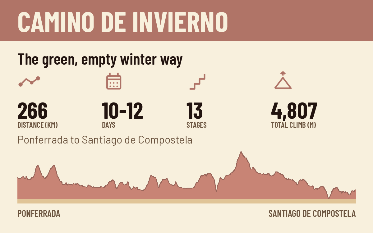
The green, empty winter way
The winter route the old pilgrims used to dodge the snow at O Cebreiro. Quiet, green, and underrated.
266 km · 10 to 12 days · Ponferrada to Santiago de Compostela
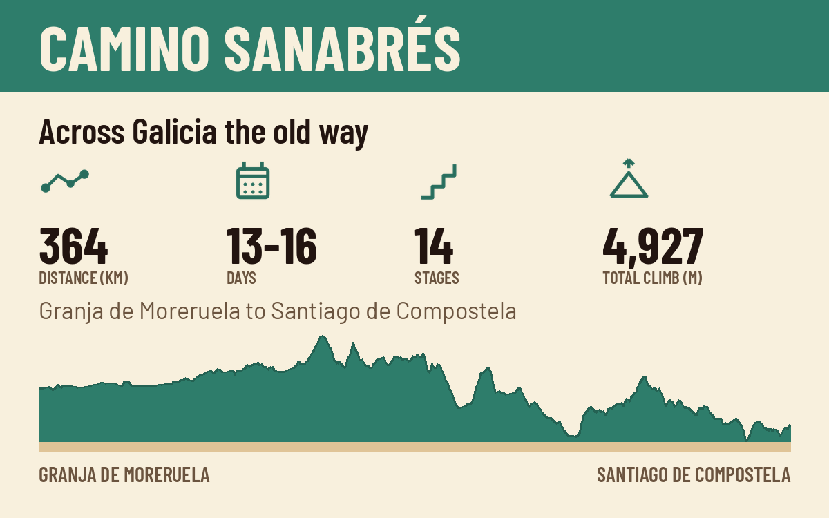
Across Galicia the old way
The Plata's quieter finish. Where the Vía de la Plata turns northwest toward Santiago.
364 km · 13 to 16 days · Granja de Moreruela to Santiago de Compostela
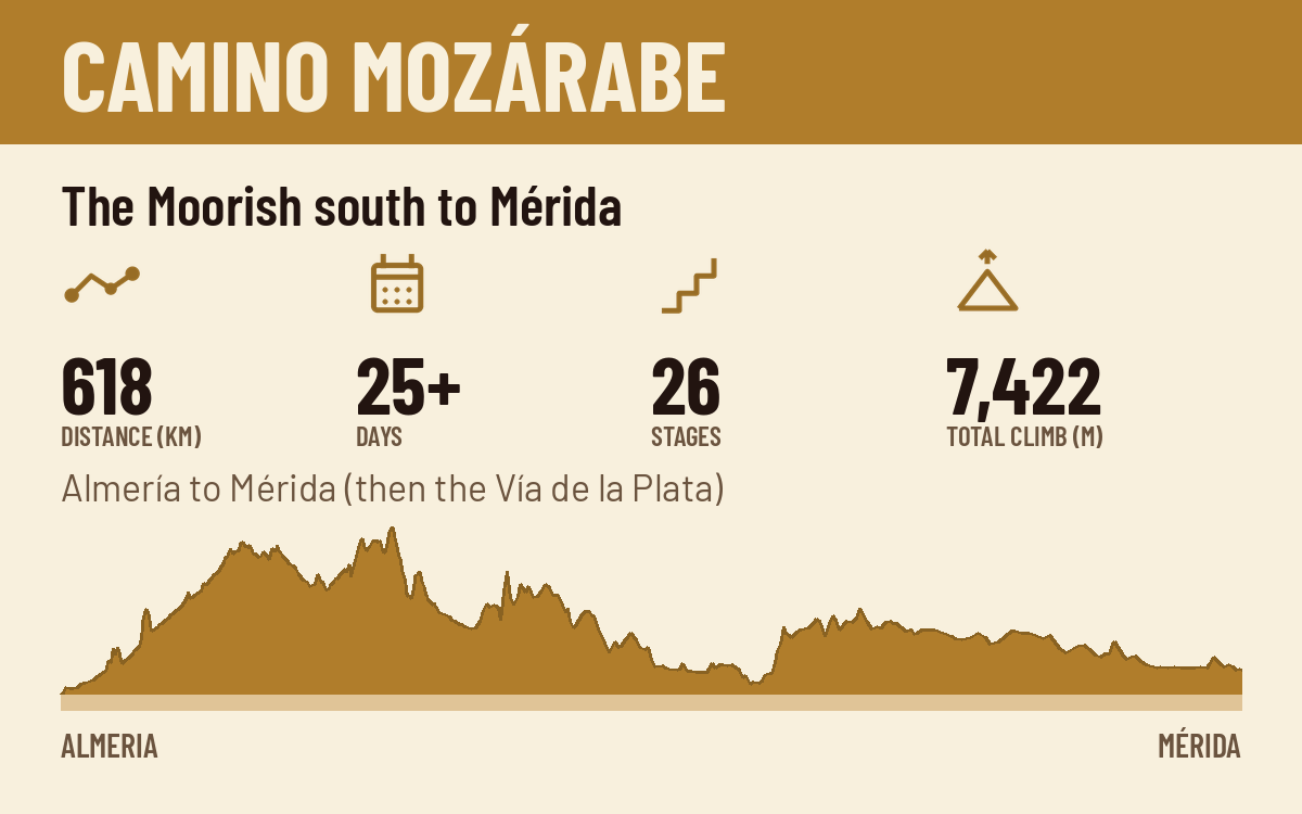
The Moorish south to Mérida
The deep south start. Granada, Córdoba, and the longest walk to Santiago in Spain.
618 km to Mérida · 25+ days to Mérida · Almería to Mérida (then the Vía de la Plata)
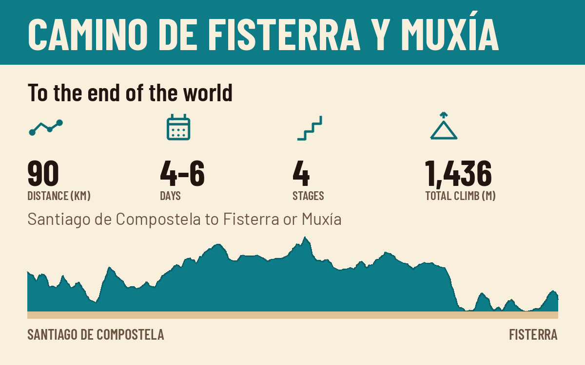
To the end of the world
The epilogue. West past Santiago to the end of the world, with two endings: the cape at Fisterra and the sanctuary at Muxía.
90 km to Fisterra, 87 km to Muxía · 4 to 6 days · Santiago de Compostela to Fisterra or Muxía
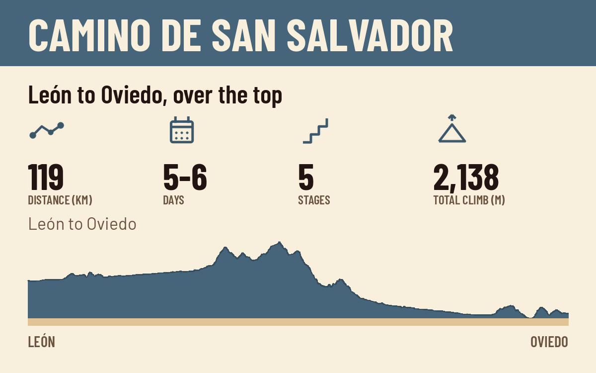
León to Oviedo, over the top
The mountain link. From León over the Cantabrian range at Pajares to Oviedo, where the Primitivo begins.
119 km · 5 to 6 days · León to Oviedo
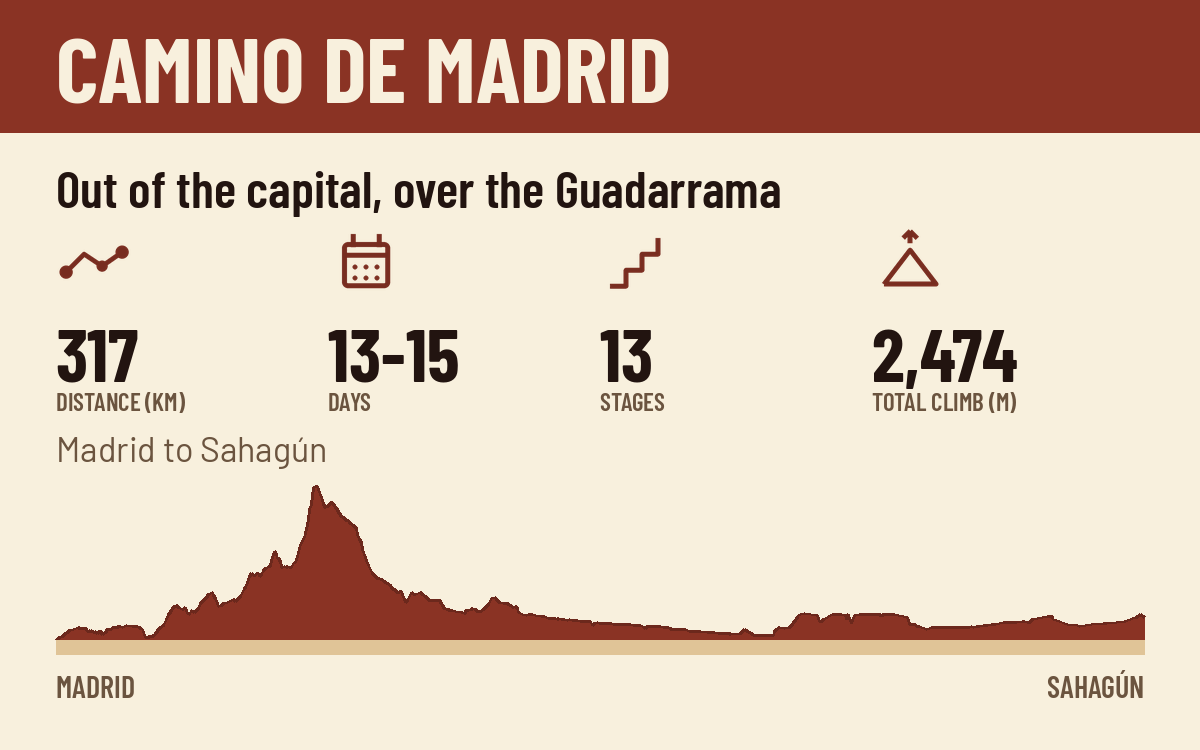
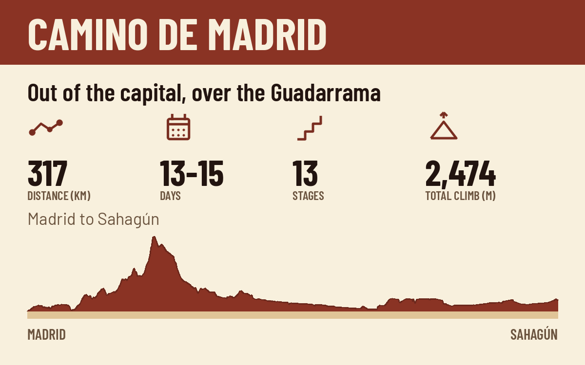
Out of the capital, over the Guadarrama
The capital's own Camino. Out of Madrid, over the Guadarrama at the Fuenfría pass to Segovia, then the long meseta to Sahagún.
317 km · 13 to 15 days · Madrid to Sahagún (then the Camino Francés)
The forgotten mountain way west
The forgotten mountain way. From Bilbao through the Mena valley and the Cantabrian foothills, then the long quiet west to Cacabelos in El Bierzo.
495 km · 18 to 20 days · Bilbao to Cacabelos (then the Camino Francés)
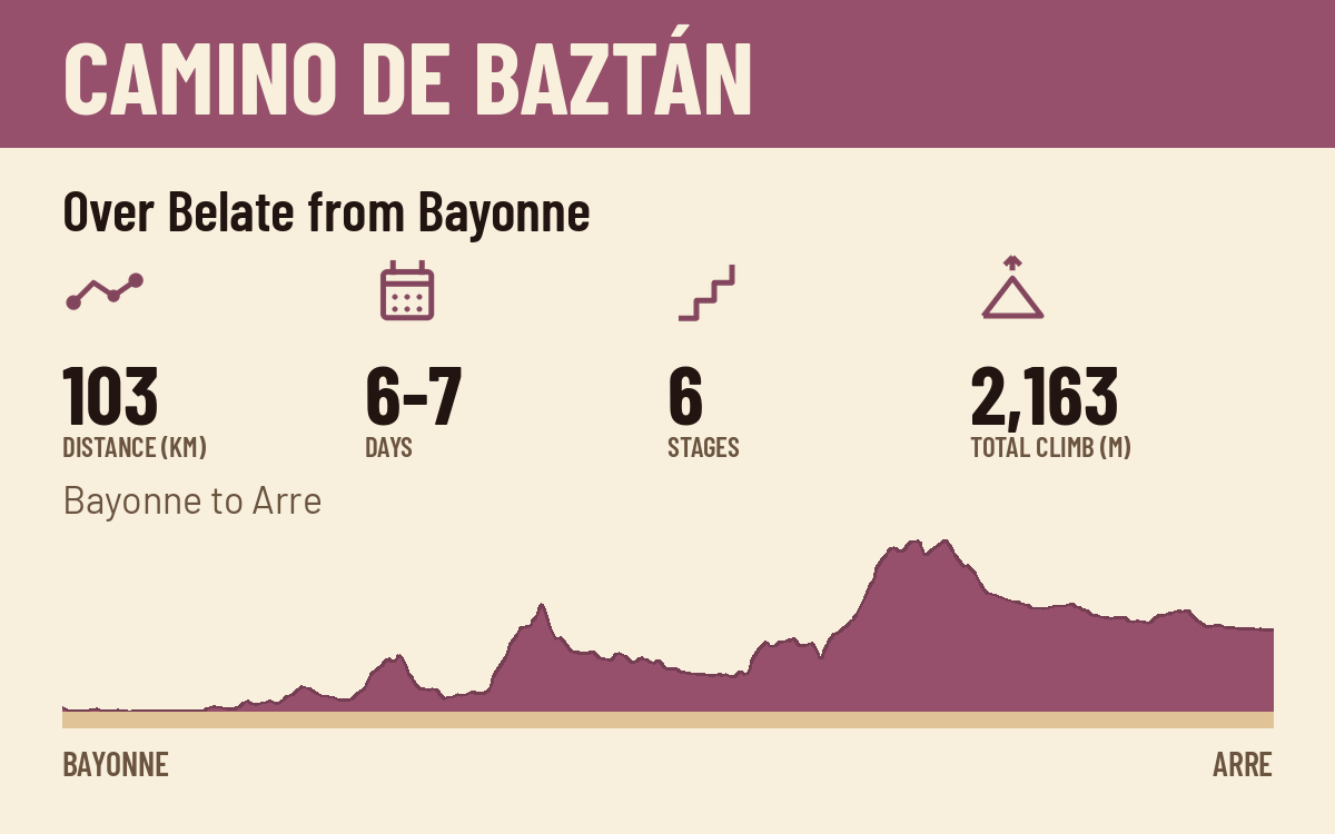
Over Belate from Bayonne
The Basque feeder. From Bayonne up the Nive and the Baztan valley, over the Belate pass to Arre, where it joins the Francés above Pamplona.
103 km · 6 to 7 days · Bayonne to Arre (then the Camino Francés)
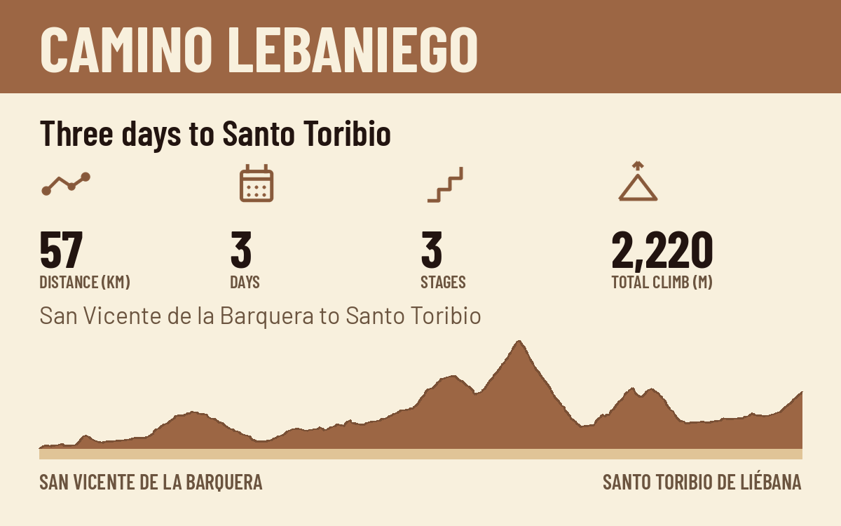
Three days to Santo Toribio
The Cantabrian pilgrimage. From the coast at San Vicente up the green valleys to Potes and the monastery of Santo Toribio, with the Senda del Nansa as its longer valley variant.
57 km · 3 days · San Vicente de la Barquera to Santo Toribio de Liébana
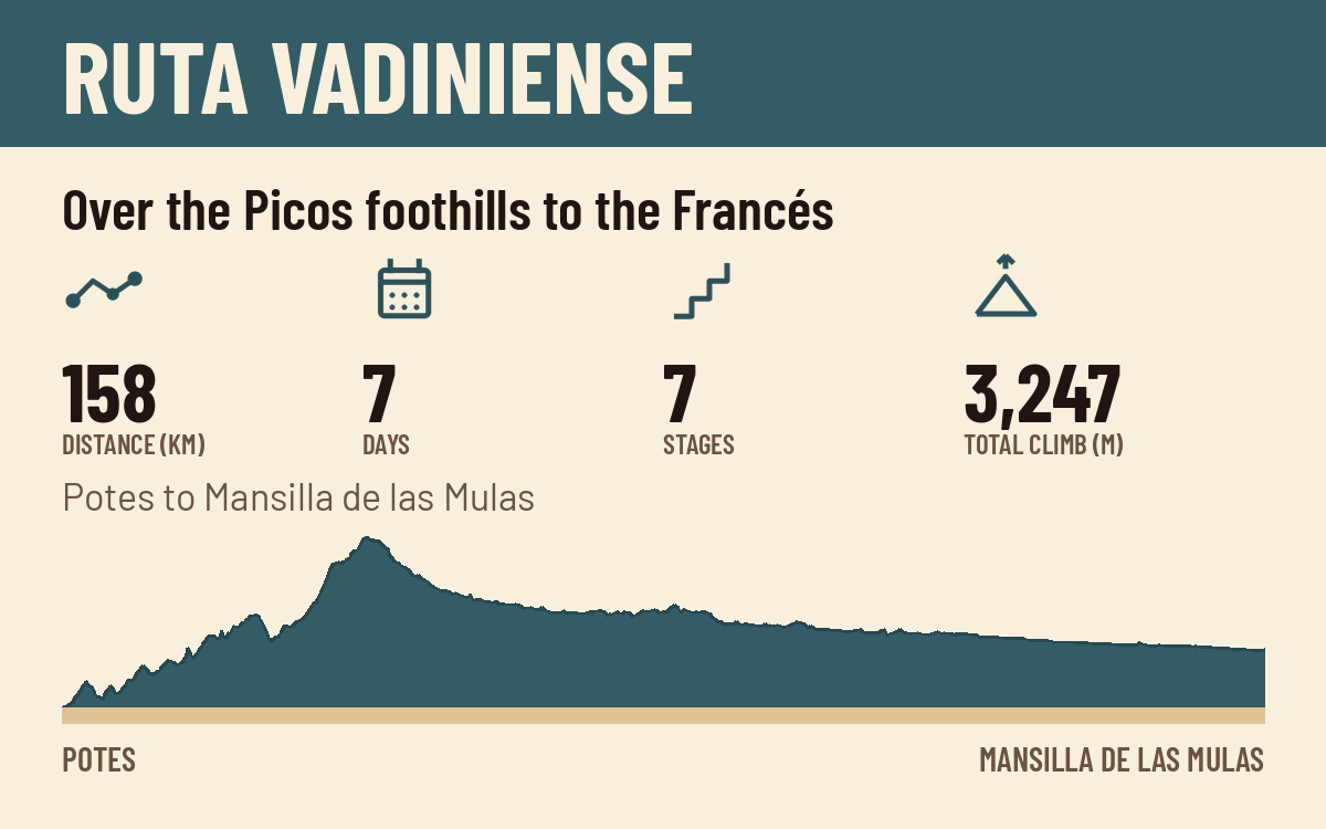
Over the Picos foothills to the Francés
The Liébana to León crossing. From Potes past Santo Toribio, over the Picos foothills past Fuente Dé and the Horcada de Valcavao, then down the Esla valley to Mansilla and the Francés.
158 km · 7 days · Potes to Mansilla de las Mulas (then the Camino Francés)
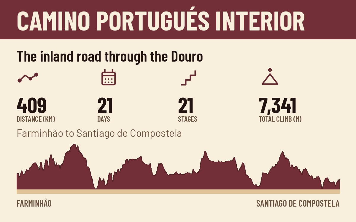
The inland road through the Douro
The inland Portuguese road. From Farminhão below Viseu through Lamego and Vila Real, across the Douro, over the border at Verín, and from Ourense on the shared Sanabrés ground to Santiago.
409 km · 21 days · Farminhão to Santiago de Compostela
Three honest questions. Thirty seconds.
One page, all 33 stages, distances in kilometers and miles, and space to write in your dates. Join the list and the planner is yours. We send route news and planning notes, never spam.
Free. Unsubscribe any time.